Outlook into the Vinschgau and to the Ortler Alps
Good 600 m below us, Castle Annenberg is hiding on the slope. Virtually one floor below in the Etsch valley lies Goldrain, opposite Morter at the entrance to the Martelltal and the dark castle hills of the Montani ruins.
On a bench along the narrow meadow climb we take a short break for 15 minutes, so that we can enjoy the opposite “hands-on” mountain panorama of Hasenöhrl and Laaser Ferner in the morning sun.
Also with our destination Schlanders, the main town ot the Vinschgau, we have first eye contact from the distance.
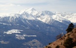
- Left: Panorama of the meadow path with Laaser Spitz (3.305 m) in the Ortler Alps.
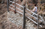
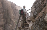
- Centre and Right: The way through the Fallerbach ravine is secured with stairs and railings.
Ruins are evidence of former settlements
At 11.15 hours we come across the ruins of Laggar (1.570 m), presumably initially a miner’s settlement from the ore mining period.
It had already been mentioned for the first time in 1290. The municipality Vetzan bought it 1913, before it was closed down in the first half of the 20th century.
Our path now leads downhill through a stretch of forest with craggy forest ground and already 10 minutes later follows the next settlement from that period with the dilapidated stonewalls of Zuckbichl (1.508 m).
After a short photo stop we continue our way at 11.35 hours by crossing the Fallerbach ravine. In this entire region of the ruins and the Fallerbach some sure-footedness is of advantage, although the path is safe and the hiker is partly being helped with stairs and railings.
The path is taking us out of the ravine on a broad farm road, which we – now again in completely open terrain – follow to Patsch (1.428 m).
Patsch is a very old settlement site from the period of ore mining. It too had been acquired by the fraction Vetzan in 1912 for pasture purposes.
At all ruins small information plates can be found, which briefly point out the historic background.
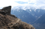
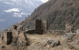
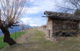
- The ruin Laggar at 1.570 m (left), the ruin Zuckbichl at 1.508 m (centre) and the Hof Patsch at 1.428 m (right) were presumably former miner’ s settlements during ore mining.

