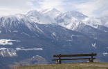
Gorgeous mountain panorama
Having enjoyed on this wonderful „observation balcony“, sheltered
from wind in the sunshine, for 45 minutes in silent togetherness,
the magnificent panorama of the dark green Nörderberg with its
snow covered peaks of the Laaser Spitz (3.305 m),
Zufrittspitze (3.439 m) and Ortler-Berge, we are now
continuing at 12.20 hours our path No. 14 to Schlanders.
(This place is perfect for a picknick, because here you can
find, sheltered from wind, tables and benches).
10 minutes later we get off the farm road, turn to the left
and follow No. 14 down the slope through sparse woodland,
repeatedly crossing the asphalted motor road that leads up
to Hof Tappein.
Option
At this point the enthusiastic hiker has the chance to take the
extended route via Castle Schlandersberg, if one remains on
the farm road, No. 11, to Hof Tappein.
Later on one meets here with the asphalted approach road, that
leads up to the farmstead. From there the “7” – again now and
then crossing the motor road –leads to the castle and to Fisolgut,
where one can stop for a bite, in order to have enough strength
for the steep and rocky descent to Schlanders.
The constant view of Schlanders, which gets closer bit by bit,
distinguishes this path, which, however, requires sure-footedness.
Whoever is not yet enchanted enough by this tour, can descent
via footpath No. 5 through the Schlandraun ravine along the
Ilzwaals to Schlanders.
Downhill to Schlanders
Our path 14 runs through a forest aisle, just like a dried out
riverbed. After further switches between motor road and forest
path we have soon afterwards arrived at a junction at an altitude
of 1000 m, which on the one hand offers the possibility to walk
over to Vetzan (No. 11) or on the other hand up to
Schlandersberg (No. 14 b).
Our path No. 14 signalizes another 40 minutes to the centre.
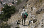
We have started to tackle the last bit of our way down to
Schlanders, that is now within one’s reach, over steps of rock.
Caution is advisable!
The mountain track ends on a big meadow, which we cross on a
narrow path. Then it goes on a bridge over the Schlandrauner
brook along an embankment on the left-hand side.
Words by Reinhard Jakubowski from Gladbeck. Pictures by Bärbel
and Reinhard
Jakubowski. They are being used with the kind
permission of the authors.
Reports and wordings of guest authors are not necessarily the
opinion of the owner of the media.


